Kapurdi Fm
Type Locality and Naming
OUTCROP: Type section is in Pond section near Rajputon ki Dhani. [Original Publication: Shrivastava, B.P. And S. Srinivasan, 1963: Geology of Bikaner-Barmer area, ONGC, Dehradun: report (Unpublished)]
Synonyms: The earliest published reference to the occurrence of Fuller’s earth at Kapurdi is of Blanford (1877). A brief mention was also made by La Touche (1902). Shrivastava and srinivasan (1963) referred to this rock unit as “Kapurdi Fuller’s earth” as an informal rock lithounit which is extensive and mappable. Siddiquie and Bahl (1965) formalized the name as Kapurdi Formation. Dasgupta et al (1973) followed the same nomenclature.
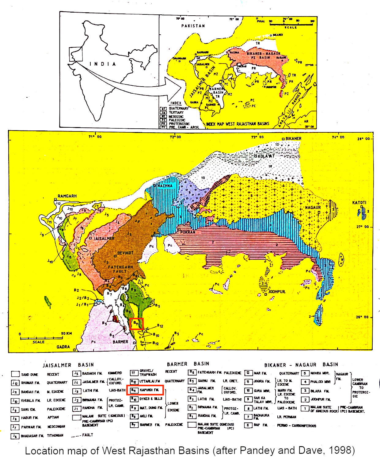
[Figure 1: Location map of West Rajasthan Basins (after Pandey and Dave, 1998)]
Lithology and Thickness
Claystone to marl. It comprises fuller’s earth with carbonaceous streaks and gypsum-rich clay in the lower part while the upper part consists of dull white argillaceous limestone and bioclastic marl. The maximum thickness of this formation in quarry section is about 12-15 m.
Relationships and Distribution
Lower contact
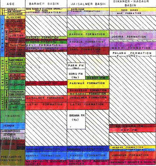
The lower boundary seems to be unconformable with underlying Mata Ji Ka Dungar Fm.
Upper contact
The upper boundary is marked by a pronounced unconformity with overlying Uttarlai Fm (Quaternary sandstone).
GeoJSON
Fossils
Lakhanpal and Bose (1951) have reported plant fossils, fish, crabs, shrimps, etc and Dasgupta et al (1975) have reported Assilina daviesi, A. granulosa and N. atacicus (mostly juvenile).
Age
Depositional setting
Additional Information

